Reporter's Notebook

America by Air
Show Newer Notes
Sebastian Gregg

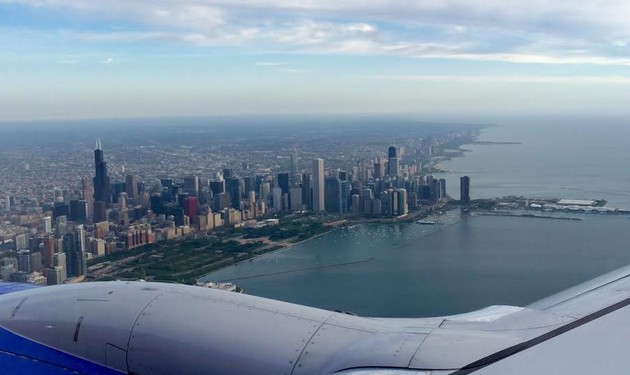
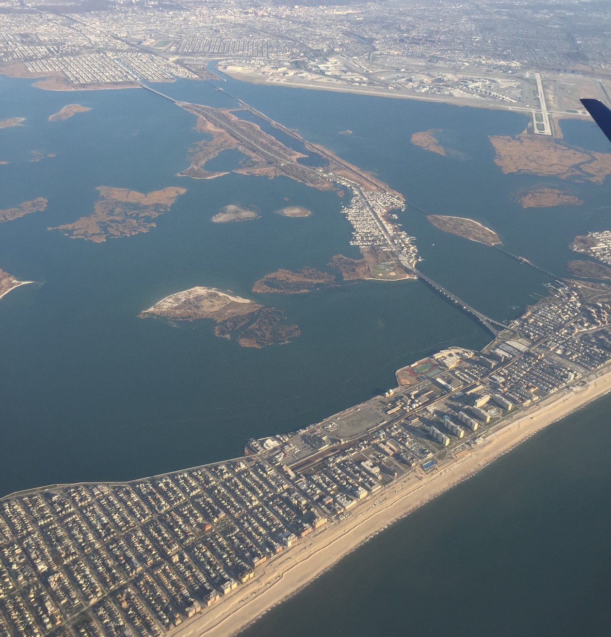
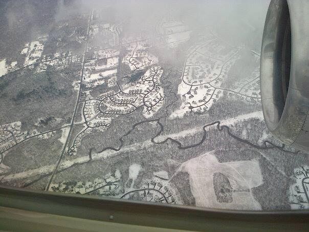
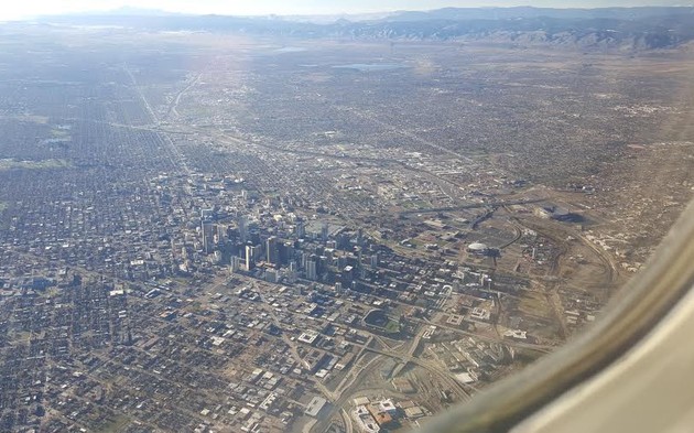
These aerial shots from readers are getting better and better:

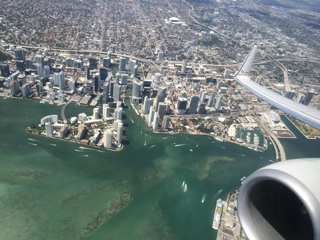
Good afternoon! I want to share my submission for America From the Air—a photo I took while flying from Miami to Guatemala City in March 2015. It was the second leg of a journey from Brazil to Guatemala. At the time, I was an American diplomat stationed at the U.S. Consulate General in Sao Paulo and starting a temporary duty assignment (TDY) at the U.S. Embassy in Guatemala City.

I am a window seat junkie who meticulously chooses my seat based on the prevailing runway patterns and last-minute checks of runways in use on flightaware.com to get the best possible views on takeoffs and landings. As a Miami native and Foreign Service Officer who didn’t get to travel home often enough, I was thrilled to see my research pay off with this colorful photo of downtown Miami and Biscayne Bay. The Brickell neighborhood and Brickell Key are to the left of the mouth of the Miami river, with the city’s center and the American Airlines Arena (which has an airplane silhouette on the roof) just below the leading edge of the 737’s wing.

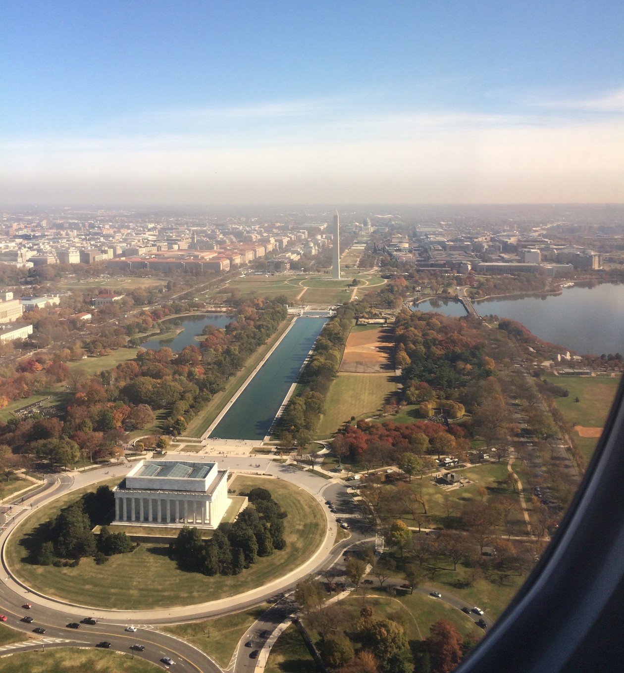
Thanks for putting together this great series, I’ve loved the submissions so far. (Especially the photo of the National Mall ... I always try and sit on the left side of the plane when flying into Reagan!)

But a wide-open scene of the Seattle skyline:

Martín Lorenzo

Details from the reader:

Flying into SeaTac on July 19, 2015. (The photo is unfiltered.) You can see the Seattle waterfront, which is dead center, where the Great Wheel is.

On-the-ground views here. It’s the tallest Ferris wheel on the West Coast, at 175 feet (53.3 m). The tallest in the U.S., and the world, is the High Roller, towering over Las Vegas at 550 foot (167.6 m). Full list here.

Laura Hagan

A reader gets nostalgic:

I lived in Mammoth Lakes, California (a ski town in the Eastern Sierra) for several years and still consider it home, even though I live in DC now. Flying from DC to San Francisco on December 7, 2015, I deliberately sat on the left side of the plane so I would be sure to see my old home as we flew by.

In the center of the shot you can see Mammoth Mountain Ski Area, with its well-defined lower runs and its great white expanse across the top of the ridge. In the lower right, you can see June Mountain, Mammoth’s smaller sister. After the terrible drought of the last several years, I was very happy to see a decent snow cover this early in the season. When I lived there from ’96 to ’03, we had several years of 400+ inches of snow and good skiing from November into June.

Seeing the place even now takes my breath away, I miss it so.

Jordan P. Williams

A well-framed shot of Chicago from May 2015:

I was onboard a Southwest flight into Midway and caught this view of the loop, all the skyscrapers and even Navy Pier! What’s really striking is the huge swath of green right along the lake—Grant Park and Millennium Park.

The latter got off to a rough start:

Some observers consider Millennium Park to be the city’s most important project since the World's Columbian Exposition of 1893.[4][5] But it far exceeded its originally proposed budget of $150 million. The final cost of $475 million was borne by Chicago taxpayers and private donors. The city paid $270 million; private donors paid the rest, and assumed roughly half of the financial responsibility for the cost overruns. The construction delays and cost overruns were attributed to poor planning, many design changes, and cronyism.

From a promotional profile of the park:

Millennium Park celebrated its 10th anniversary season last year [2004] and in 2015 will continue to present dozens of free events and programs including art installations, outdoor concerts, films screenings, alfresco workouts and more.

All year round, “The Bean” is an iconic draw for visitors and locals alike. Take a picture in front of Cloud Gate, the official name for the massive, stainless steel structure that’s become Chicago’s signature landmark. In its mirror-like surface you’ll see not only your own reflection but the downtown skyline.

During the winter months, lace up your skates for ice skating amid twinkling tree lights at the McCormick Tribune Ice Rink. Or escape into Lurie Garden, an urban oasis that pays homage to Chicago's motto — “Urbs in Horto,” or City in a Garden.

In the warmer months, spread out a blanket in front of the award-winning Pritzker Pavilion for a live performance. Cool off by splashing around in Millennium Park’s Crown Fountain, a shallow reflecting pool bookended by 50-foot towers. Grab food and drinks at the alfresco patio Park Grill, or burn off those calories during a Saturday morning workout on the Great Lawn.

Matthew Schaidle

From a 2nd lieutenant in the Marine Corps:

This photo was taken on November 11, 2014, when I was arriving at Reagan National (DCA) from Boston (BOS). It had been a great trip, visiting such a historic town with a close military friend on Veterans Day. As I looked out the window during the final descent, I realized I picked the right side of the plane to see a stunning view of the nation’s capital. I pulled out my phone just in time to capture this view of the Lincoln Memorial, Washington Memorial, Reflecting Pool, White House (barely), Capitol Building, and the rest of the National Mall.

The Watergate, where The Atlantic is headquartered, is just out of frame.

Tim Heffernan, an Atlantic alum who has written several great pieces for the magazine, sends an agita inducing view:

This is a bit of a cheat for the series since I wasn’t actually airborne, but a few years ago I toured the Empire State Building as a journalist and got to go out on the open-air catwalk beneath the radio mast—effectively the 103rd floor. The T-shaped doohickey is a lightning rod. And that parapet is very very low, maybe knee-height on me. When I remarked on this, my guide told me to quit being such a baby; she had taken a bunch of Knicks players out there too, and the wall barely reached over their shoe-tops. On a CBS visit in 2013, they learned that the deck of the catwalk has been lowered in order to make the parapet wall higher. Here you can see how low it was when I was up there (it’s the silver-painted part of the wall).

Rosa Smith

Our social media fellow, Rosa, adds a gorgeous shot to the series (which you can still contribute to):

This is Mt. Hood in January 2015, seen from the south on a flight departing Portland, Oregon. There is less snow than there should be for January, and you can see a dark spot on the right near the summit where volcanic activity is melting the snow. Mt. St. Helens, Mt. Rainier, and Mt. Adams are all visible in the background (Mt. Adams at the very tip of the wing).

I was lucky to get plenty of powder when I skied at Mount Hood Meadows with my brother in late December. And according to this report from Friday on a winter storm, things are looking good for Hood:

The fresh batch of snow is good news in northwest Oregon, where a once-robust snowpack dropped below normal in the Central Cascades and Mount Hood following February’s stretch of warm weather. Central Cascade snow-water equivalent was 85 percent of normal and Mount Hood 81 percent of normal as of Feb. 19. The influx of snow should bounce that number closer to 100 percent, where it has been most of the season.

Matthew Lore

Our latest reader in the series writes:

This photo was taken aboard a federal contract jet departing Fairbanks, Alaska, and destined for the National Interagency Fire Center in Boise, Idaho. Flights like these shuttled back and forth between Alaska and the lower 48 throughout the summer, transiting some of the many firefighters dispatched to Alaska to help fight  forest fires burning there during the summer of 2015. The crews aboard this flight were returning to their normal duty stations across Idaho after completing two week assignments in Alaska.

Callie Snyder

A reader recounts an incredible trip:

This past September I accompanied my boyfriend when he piloted his Cessna 170 on a cross country flight from Anchorage, Alaska to Lockhart, Texas (30 miles from Austin). The entire trip took eight days. We passed over these glaciers and mountains on the first day en route to Prince William Sound.

From there, we proceeded south down the coast. We camped on the beach at Icy Bay the first night and stayed in a historic hotel in Juneau the next. We went inland at Prince Rupert, British Columbia, the following day and spent the next two nights in Canada—in a hotel in Terrace one night and camping on a grass strip maintained by a hang gliding club in Hope on the second night.

We crossed back into the states at Oroville, Washington, camping on the tarmac that night in Odessa, where we ended up crashing their annual Deutschesfest celebration. The next day, we flew out of Washington, eastern Oregon, Idaho, Nevada, and on into Utah, spending the night in South Provo. On the second to last day, we flew over the four corners—Utah, Arizona, Colorado, and New Mexico—and spent our final night in Santa Rosa, New Mexico.

It was a tremendous way to experience an incredible number of stunning landscapes in a relatively short segment of time.

Anoop Bhargava

Our reader Anoop took this photo “flying over JFK in November,” with the Rockaways in the foreground. Some quick history of the airport:

It was built to relieve LaGuardia Airport, which was overcrowded soon after opening in 1939. Construction began in 1943, and about $60 million was initially spent of governmental funding, but only 1,000 acres (400 ha) of land on the site of the Idlewild Golf Course were earmarked for use. In March 1948 the New York City Council changed the name to New York International Airport, Anderson Field, but the common name was “Idlewild” until 1963. The airport was renamed John F. Kennedy International Airport on December 24, 1963, a month after the assassination of President John F. Kennedy.

Steven Heiss

It was a city built on gold:

The Denver area, part of the Territory of Kansas, was sparsely settled until the late 1850s. In July 1858, Green Russell and Sam Bates found a small placer deposit near the mouth of Little Dry Creek (in the present-day suburb of Englewood) that yielded about 20 troy ounces (620 g) of gold, the first significant gold discovery in the Rocky Mountain region. News spread rapidly and by autumn, hundreds of men were working along the South Platte River. By spring 1859, tens of thousands of gold seekers arrived and the Pike’s Peak Gold Rush was under way. In the following two years, about 100,000 gold seekers flocked to the region.

In the summer of 1858 a group from Lawrence, Kansas, arrived and established Montana City on the banks of the South Platte River (modern-day Grant-Frontier Park). This was the first settlement in what would become the Denver Metropolitan Area.

The name of the site was changed to “Denver City” after Kansas Territorial Governor James W. Denver, in an attempt to ensure that the city would become the county seat of then Arapaho County, Kansas. Ironically, when General William Larimer, a land speculator from eastern Kansas, named the city after Denver to curry favor with him, Denver had already resigned as governor and no longer had say in naming the capitol.

Denver at first was a mining settlement, where gold prospectors panned gold from the sands of Cherry Creek and the South Platte River. Larimer, along with associates in the Denver City Land Company, laid out the roads parallel to the creek and sold parcels in the town to merchants and miners, with the intention of creating a major city that would cater to new immigrants. In the early years, land parcels were often traded for grubstakes or gambled away by miners in Auraria.

But the prospectors discovered that the gold deposits in these streams were discouragingly poor and quickly exhausted. When rich gold deposits were discovered in the mountains west of Denver in early 1859 it appeared that Denver City might become a ghost town as prospectors left for more lucrative claims. But once the gold rush began there was a great need for materials that couldn’t be produced locally which assured Denver's future as a supply hub for the new mines.

More Notes From The Atlantic
  • Notes Home