The Shifty Earth
Modern science has penetrated the mysteries of space, but the nature of the earth’s depths remains to be explored. N. J. BERRILL here gives us an account of the theories thus far advanced by geologists and biologists regarding our changing planet. Mr. Berrill is professor of zoology at McGill University and the author of several books, includingJOURNEY INTO WONDER, SEX AND THE NATURE OF THINGS,andMAN’S EMERGING MIND.
N. J. BERRILL
IN THE early days of geological science, a bitter battle was waged between the catastrophists, who regarded earth history as a series of violent transforming events, and the uniformitarians, who considered the surface structure of the globe to be the result of continuous, insidious processes still going on before our eyes, producing great effects because of the immensity of time. There was obviously so much truth in the uniformitarian concept and so much misconception in the catastrophist one that the verdict in favor of the former seemed to be final.
This comfortable state of mind has now been changed, for the earth is suspected of the grossest forms of misbehavior in terms of its nineteenthcentury respectability. We hear of wandering poles and drifting continents, of submarine cracks in the earth’s crust engirdling the planet. Oldschool geologists hold tight to the belief that the earth is contracting and throwing up mountain ranges like wrinkles on an aging face. Others are beginning to think of the earth as more like an expanding balloon, in step with an expanding universe. The outcome is not clear, but the present phase of inquiry is exciting because the newer data suggest various possibilities and speculation is given full play.
The two partners in this drama of understanding and misunderstanding are the geologists and the biologists. Biologists have been puzzled by the remains of swamp cypress in Greenland, a relic of subtropical conditions. Was the Arctic ever as warm as that? Ostriches, under different names, occur in Africa, Australia, and South America, accompanied in each case by the same long list of ostrich parasites. Did they become ostrichlike independently after flying across the oceans? The parasites say no. Yet, if they were ostriches to begin with, they must have walked, but walked across what?
The biologist has had no trouble finding an answer, for he can dream up a land bridge at the drop of a hat, and then all goes well till the geologists hear about it, when down it goes, and we are back where we started. Only one bridge has been generally conceded, that across the Bering Strait. This is hardly a strait in any case, for it is very short and very shallow, and biological traffic unquestionably has been using it both ways for time out of mind. If you will look at the globe from the north polar region, you will see what this means, for it establishes a world continent that leaves little out of reach. Some creatures, notably elephants and mastodons, undoubtedly plodded the long way around from their original home in North Africa, across Siberia and south along the Cordilleras, well into the highlands of South America. And what elephants have done, some biologists have felt, the other forms of life could do better.
Yet one look at the map of the world is suggestive in another way. We are all familiar with Mercator’s projection, which is good in the middle but plays havoc with the poles, and the jigsaw fitting of South America and Africa is unmistakable. Francis Bacon saw it first, and he suggested that the two continents had originally been joined together but had drifted apart. This was pretty quick off the mark, inasmuch as Columbus had discovered the western side of the Atlantic Ocean fewer than one hundred years earlier. The concept of drifting continents is, therefore, far from new. What is new is a certain respectability.
The idea of pole wandering also goes back to the early days of scientific thought, to the eighteenth century at least. It appears in correspondence between Edmund Halley, of comet fame, and Sir Robert Hooke, and was invoked as an explanation of the occurrence of marine fossils in sedimentary rocks well above sea level. Later on, the catastrophists held on to the shifting poles as an essential factor in the evolution of the earth’s crust, but Darwin, always an ardent disciple of the uniformitarian school, supposedly demolished the hypothesis in a decisive manner. Now this, too, is back again, with new support, and so the game goes on. After all, there are few more enjoyable and, in practice, less harmful exercises than mentally sliding the crust of the earth about, as a whole or in part, to see what you can make of it. Both continental drift and pole wandering hypotheses are welcome to biologists, for together they can be made to explain all the problems of the past and present distribution of animals and plants, although wishful thinking is no proof.
The theory of continental drift received its first thorough presentation from the German geographer Alfred Wegener early in the twentieth century, and a lively argument extended through the 1920s, with geologists contending that the evidence was weak and that continental drift is incompatible with the strength of the earth’s interior, and biologists accepting drift as an enchanting alternative to hypothetical bridges. Among the geologists, only the petroleum geologists, whose business it is to drill deep for oil where seas used to be, were persuaded that drift really had occurred.
It is significant, however, that the main reason for rejection by the majority was their inability to conceive a mechanism or forces by which continental drift could be brought about, which is an objection in line with that of two engineers who calculated that it was physically impossible for a bumblebee to fly. So, for about another twentyfive years, continental drift remained a geological heresy and a biologist’s dream. Now, with radically new evidence at hand, much of it obtained during the International Geophysical Year and its aftermath, the question is receiving its first serious consideration.
Pole wandering and continental drift are distinct concepts. One is possible without the other. Pole wandering implies that the earth’s crust as a whole and the axis of rotation have changed relative to one another, but it does not change the map of the world as we know it, apart from relative climatic effects. Continental drift implies that continents have changed their position relative to one another, but does not involve any relative shift of the axis of rotation. Proof for one is not proof for the other, nor is disproof. On the other hand, if both pole wandering and continental drift do take place, the underlying cause may possibly be the same.
THE WANDERING POLES
Leaving aside the question of whether we can put continents together like pieces of a jigsaw puzzle, one of the more impressive forms of evidence suggesting that the earth’s surface has in some way slipped about during the geological past comes from the study of paleoclimates. At the present time, the pattern of distribution of plants and animals of the world is controlled to a great extent by the climatic belts. The warm tropical belt is nonseasonal and has its own characteristics on land and in the sea. The polar regions are equally distinctive in other ways. And the temperate belts in between are outstandingly seasonal.
Altogether, the climatic zoning from poles to equator is in striking relation to the polar axis, or axis of rotation, both with regard to temperature and to atmospheric and oceanic circulation. These are the factors which above all affect the growth and distribution of living things, and in this respect what is true now has undoubtedly been true throughout the ages.
Fossil plants and animals can often indicate the conditions under which they lived. Coal, for instance, has been laid down only in moist climates, and coal of a particular geological period represents the fossilized remains of vegetation of a particular moist climatic zone, either tropical or temperate. If the zone was temperate, cross sections of fossil stems or trunks show annual growth rings comparable to the annual tree rings we see in temperate-zone trees at the present time; if the zone was tropical, and therefore not subject to seasonal fluctuation in the rate of growth, such rings are absent.
Coal deposits of tropical character, laid down during the Carboniferous and Peruvian periods two to three hundred million years ago, are distributed within a girdle of equatorial rainfall that indicates a south pole somewhere in the region of southeast Africa, and the distribution of temperate-zone fossil plants of the same periods conforms to this. A south pole in that region would require the north pole to be roughly in the middle of the North Pacific, suggesting that either the axis of rotation at that time was inclined about 70 degrees to the present axis, which geophysicists say is impossible, or the thin solid crust of the earth has slipped over the underlying mantle to that extent. So far as climatic belts are concerned, relative to the position of the land masses, the result is the same: temperate lands move into the tropics, tropical lands move out of the tropics, polar lands move into temperate zones, and other temperate lands move toward the poles.
FOSSIL ANIMALS
If the past distribution of tropical and temperate plants truly indicates that the climatic zoning of the earth, although of the same general pattern as at present, was greatly displaced relative to the present axis of rotation, what is needed is confirmatory evidence of another kind. This is now forthcoming, both from fossil animals and fossil winds. Most animals, of course, are free to wander, and their fossil remains supply questionable evidence of their normal surroundings. Corals, however, are as anchored to a spot as any plant, and are also unusually sensitive to conditions of temperature. Corals growing in the constant temperature belt of tropical seas, between Capricorn and Cancer, grow uniformly at a high annual growth rate. In the seasonally variable marginal belts, they grow interruptedly and record the growth rhythm in the form of rhythmically banded skeletons, each rhythm representing one year’s growth, as in the annual rings of trees.
The distribution of fossil corals has been worked out for various geological periods. That for the Silurian period, for example, close to four hundred million years ago, shows the full tropical types of coral in the American Arctic, Japan, Korea, southern China, and east Australia, with marginal region corals in Turkey, Bohemia, Gotland, the British Isles, eastern Canada, and Newfoundland. If these places are plotted on a globe, they indicate a Silurian equator passing through the present poles, with the Silurian north pole in the mid-Pacific. This is in keeping with the circumstantial evidence of the pole position suggested by the distribution of the primitive land plants of the later Carboniferous period. The corals and plants accordingly tell the same kind of story — that the climatic zones of those periods were arranged about an axis varying roughly 70 to 80 degrees from the present axis.
FOSSIL WINDS
The third line of paleoclimatic evidence concerns the wind direction. No matter where the equator and the poles may have been in the past, it is assumed that the general atmospheric circulation pattern has been fairly constant, with the trade winds blowing constantly toward the equator from the northeast and southeast, as they do now. Steady winds, such as the trade winds, blow sand into dunes in coastal or desert regions. Sand dunes acquire a long slope into the wind and a steep slope on the leeward side and may retain this configuration as they become sedimentary sandstone rock.
By examining the lay and direction of old deposits of this sort, the direction of ancient winds can be estimated. In this way, for instance, the direction of the prevailing winds on the shores of islands that once stood in ancient Paleozoic seas, where Wisconsin now is, has been determined. They may be no more than rough indications, but, for what they are worth, they also imply a north pole in the mid-Pacific north of the equator.
FOSSIL MAGNETS
The recent upsurge of interest in the hypotheses of pole wandering and continental drift is the result of an entirely new sort of evidence which confirms the conclusions concerning the displacement of the paleoclimatic zones relative to the present axis of rotation. This is the discovery of paleomagnetism, which means that rocks magnetized by the earth’s magnetic field long ago retain that magnetization indefinitely. Natural compass needles in the form of grains of magnetic iron oxides, such as magnetite and hematite, are well known. At high temperatures, they readily line up along a weak magnetic field. When hot molten lava pours out onto the surface from a volcano, the iron mineral grains become magnetized in the direction of the local geomagnetic field. After the lava cools, the grains can no longer be influenced by the earth’s magnetic field, and they become magnetic fossils.
In certain parts of the world, the lava flows have piled up in hundreds of layers, thus providing a calendar of magnetic history, particularly in Iceland and the northwest United States. The fossil magnets reflect the pattern of the earth’s magnetic field at the time they cooled, and accordingly indicate the position of the magnetic poles at that time. The relation of the magnetic axis to the axis of rotation therefore becomes important if we are to use this evidence in connection with the position of the geographic poles.
The distribution of the earth’s magnetic field is similar to that which could be produced by a dipole magnet placed near the center of the earth, and it is likely that the earth field is generated within the fluid metallic core. Inasmuch as the magnetic axis is somewhat inclined to the rotational axis and moves gradually around the latter, it is possible that the earth’s core is turning slowly westward with respect to the mantle.
There are other peculiarities, such as periodic reversals of the magnetic poles, but there is no doubt that the magnetic field as a whole is gyroscopically controlled by the earth’s rotation and that information concerning the position of the magnetic axis also gives the approximate position of the rotational axis, and therefore the position of the geographic poles.
Any freely suspended compass needle, whether it is a man-made needle poised in a container or an iron mineral grain in molten rock, registers direction and dip. It points toward the magnetic poles on the earth’s surface no matter where the compass happens to be, but it dips downward to a varying degree according to the latitude. At the equator, a magnetized needle or grain lies horizontal to the earth’s surface. At either of the magnetic poles, one end will point directly downward toward the center of the earth if free to so move. In between, the angle of dip is an accurate reflection of the latitude. Fossil magnets retain their dip as well as their direction. Consequently, where they have lain undisturbed, they record not only the relative position of the poles but also the latitude of the rock at the time the rock was formed.
So far as the value of paleomagnetic evidence is concerned, everything depends on the assumption that the earth’s magnetic field can be represented by a dipole magnet nearly coaxial with the rotational axis. If this assumption is not valid, the conclusions from paleomagnetism become meaningless. Yet, the assumption is in accordance with the dynamo theories of the earth’s magnetic field now generally accepted.
It is significant that the magnetic fossils incorporated in the succession of lava flows in Iceland as far back as the Miocene period of twenty million years ago show no significant departure from the present relationship and positions of the magnetic and geographic poles, but when paleomagnetic data from older geological periods are examined, marked departures from the present become evident; and in England, for instance, paleomagnetic data from rocks about two hundred million years old, which were laid down when the age of reptiles was getting under way, indicate that, relatively, England was much closer to the equator of that time, and was also rotated considerably in relation to the present polar axis. Data from India indicate that India also was far south of its present position, far enough south, in fact, to have been heavily glaciated at a time when there were no high mountains, and was also rotated during that period, relative to the present axis.
Paleomagnetic data have been steadily accumulating from studies made in America, Europe, and Asia from rocks representing geological periods as far back as the Pre-Cambrian, about six hundred million years ago. From each continent we get the same story; namely, that the north pole has progressively shifted from a mid-Pacific position just north of the equator to its present position in the landlocked Arctic Ocean, during a period of several hundred million years, which is a conclusion closely compatible with that derived from studies of plant and animal distribution for the same period.
We have a choice, therefore, of three possibilities: both lines of evidence are false, the earth’s axis of rotation has shifted through about 90 degrees since Pre-Cambrian times; the earth’s axis of rotation has not changed, but the earth’s solid crust has slowly slipped over the plastic mantle, so that at different periods, different areas of the earth’s surface have been brought into polar and equatorial positions. If the evidence is valid, the last interpretation is the most likely.
We now come to a curious discrepancy. The data from each continent for tracing the polar path through geological time are consistent within themselves; that is, the latitudinal position of the north pole in each case changes from a position near the present equator to the present pole. But, longitudinally, the paths traced from India, North America, and Europe respectively do not coincide and represent a wide divergence. This could mean that the continents have moved apart from one another during the period of polar wandering— in other words, that continental drift of great extent has coincided with the movement of the earth’s crust as a whole. If this is the case, the paleomagnetic data are explained, and so are many striking interruptions of sedimentary rocks and animal and plant distribution.
The weakness of the hypotheses has been the circumstantial nature of the evidence and the difficulty in conceiving forces powerful enough to cause such movements of the crust relative to the mantle and of continents relative to one another. How could deeply rooted continental masses plow their way through the oceanic abyssal crust? And so on. In the last few years, investigations of the ocean floor have been throwing an entirely new light upon the problem.
THE SUBMARINE RIFTS
About half the area of the earth’s surface is covered by deep ocean, the other half by the continents and submerged continental shelves. Quite apart from the question of water, the two areas are in sharp contrast with regard to the nature of the crust. A division, or transition zone, known as the Mohorovicic discontinuity, separates the crystalline, basaltic rock of the lower layer of the crust from the denser, noncrystalline rock of the underlying mantle.
This boundary lies much deeper beneath the continents than it does below the ocean floor, as if the crust of the earth consists of relatively light but thick continental blocks and thin but dense oceanic material, both of which seem to float on the mantle. The continental blocks are about thirty miles thick, whereas the crust on the ocean floor is only six or seven miles thick. Hence the present Mohole project, which is intended to drill through the relatively thin ocean floor crust down to the Mohorovicic discontinuity, and possibly into the mantle itself.
Relative thickness, however, is not the only distinction between the crustal areas of continents and oceans. Some types of earthquake waves originating below the oceans fail to reach land stations, while similar waves originating on land fail to reach island stations, constituting strong evidence that the earth’s mantle as well as the crust is divided into distinct continental and oceanic provinces. These are two crustal features of the first order of magnitude. As the result of oceanographic investigations of the last few years, we must now add a third.
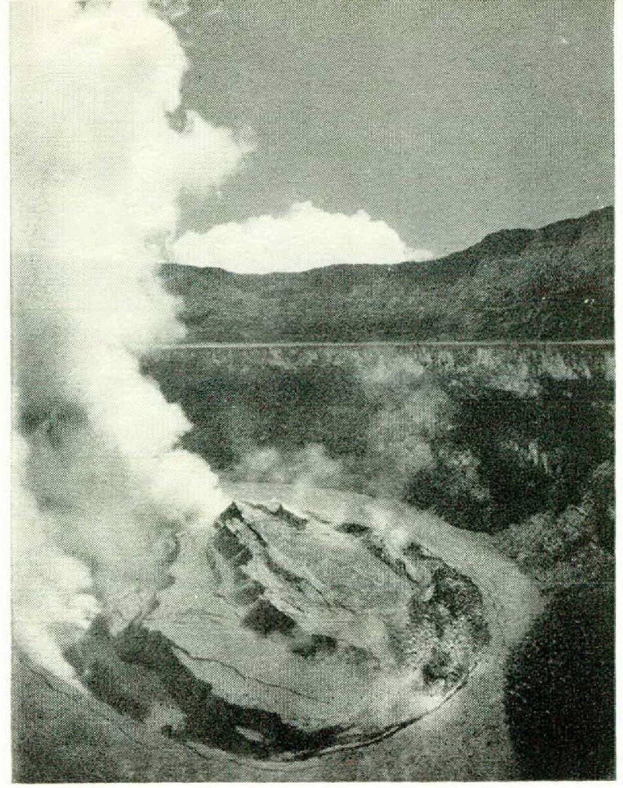
This is a submarine mountain range that extends for forty thousand miles across the bottoms of all oceans and embraces an area almost as large as the exposed regions of the continents. It is still incompletely mapped, but the most curious aspect of it is that the ridge is split, apparently, throughout its length to form a deep canyon, or rift, which is the site of most earthquakes of submarine origin. The rifted ridge has now been traced from the north Siberian coast across the floor of the Arctic Ocean and south through Iceland to the South Atlantic, running roughly halfway between the continents and parallel to the opposing coastlines. It then swings easterly through the Indian Ocean, with an arm extending north through the Red Sea to Turkey, together with a branch into Africa, forming the Great Rift Valley of that continent.
The main rift continues south of Australia and across the South Pacific to swing north into the Gulf of California, along the San Andreas fault of southern California, which was responsible for the San Francisco earthquake, and then offshore along the coast and finally into Alaska. For the most part, the floor of this submarine rift valley lies about six thousand feet below the flanking ridges.
Such evidence as we have shows that these are not ranges of folded mountains, such as we see on land, but are the result of the piling up and overflowing of lava that is continually welling up through the rift itself. Evidently, the rift is a crack clean through the crust, running one and a half times around the earth. Any interpretation of the nature and history of the earth must include it as a major feature, ranking with continents and oceans.
All this is grist to the mill for the continental drifters and is unwanted fact for those who still like to think of the earth as a once red-hot molten body, still contracting and shriveling at its surface as the cooling process drags out its time. One school of drifters holds that the mid-Atlantic ridge is a fragment of the great continent that fractured lengthwise into two continents which drifted apart, a lost Atlantis of an older time. Others have considered the ridge to be a mass of sediment that filled up the crack as the two hemispheres pulled apart, in which case deep-sea dredges should bring up fragments of sedimentary rock and continental granite, which they do not. Actually, the dredges bring up basaltic lava and rock material thought to be from the mantle itself. None of it is old, and it is constantly changing. Moreover, earthquake waves travel through it much too fast for it to be an abandoned fragment of a continent.
In the Pacific, in addition to the rift running alongside the whole length of the Americas, there are fracture zones extending westward through the ocean floor from Mexico and southern California, all forming part of a deep trough three thousand miles long and flanked by mountainous ranges several thousand feet high. South of the trough, the sea floor is raised like a submarine continent, though with a crust even thinner than that of the ocean floor generally and exhibiting an outflow of heat that denotes subcrustal activity of great intensity and extent.
THE EXPANDING EARTH
Clearly, something is going on below the earth’s crust beneath the oceans that makes continental activities seem somewhat tame. One theory is that convection currents in the viscous material of the mantle rise to the crust just under the midocean ridge, forcing material out through the crack and pulling the rift apart. The same movement might add material to the underside of continents, compressing them horizontally and producing folded mountain ranges. This explanation ignores all paleomagnetic evidence. If, however, we accept paleomagnetism at its face value, we now begin to get a new and rather startling picture of an evolving earth.
Continental drift, in its original sense of continental masses plowing through the basaltic floor of the ocean without causing any great deformations in the floor, has presented great difficulties in terms of necessary forces and resistance. If the American continents have been drifting westward in this way, the Atlantic rift should be widening and the Pacific rift should be closing, whereas both appear to be opening up. An explanation which seems to fit the facts better and accounts for more of them is that the earth is neither stable nor a contracting sphere, but is slowly expanding.
The concept of an expanding earth was proposed several decades ago on cosmological grounds, and since then on the basis of other postulated changes in the earth’s interior. In any case, there is accumulating evidence that the earth’s metallic core is still growing and that lighter material continues to move outward. In fact, all the water comprising the present oceans is now generally considered to have been squeezed out through the crust from sources in the mantle during the geological ages, a process actively continuing at the present time. If the earth has been slowly expanding ever since it first became a globe, and if the continents have remained much the same in area as at first, additional crust would have to be formed. This, apparently, is just what is happening in the mid-ocean rift throughout its forty-thousand-mile length.
In other words, the continental masses have not been “drifting" apart, in the simple meaning of the word, but have been and are being pushed apart by the continuous formation of new crust in between. If so, this would account for the different paths of polar wandering plotted for the several continents — implying, of course, that much of the continental separation owing to expansion has occurred since the greater part of the supposed polar wandering took place. It is conceivable that in place of the older picture which we have had, of a primitive earth completely covered by an ocean through which clusters of volcanoes emerged and by erosion began to build the rudiments of continents, the earth was much smaller and was originally completely covered by an unbroken shell of granite. With the onset of the expansion process, the shell cracked into several continental components.
As the process continued, new crust continually formed from the material welling out through the crack, though of a different substance and much thinner than the original crust. The thinnest and youngest part of the earth’s crust should, accordingly, be in the center of the mid-ocean ridge. The rift floor within the ridge is undoubtedly very thin, and the argon-potassium radioactive dating technique puts the age of the ridge material at not more than ten million years, which is very young indeed, geologically speaking.
If there has been no continental drift in a literal sense, the effect of expansion is essentially the same. The continental masses have become widely separated by ever-deepening oceans during geological history, although not without some real displacement and collision of parts of the continental segments. Even now that part of California west of the San Andreas fault — that is, west of the line passing from San Francisco south through the Gulf of California — is undergoing a lateral shift and a clockwise rotation that can be measured.
And, on other evidence, it appears that Spain was once joined by its present northern coast to the west coast of France and has not only split off but has rotated counterclockwise about a pivot in the northeast part. Such a movement has left the Bay of Biscay as the rift between and has swung the original southern region against adjacent land, thrusting and folding up to form the Pyrenees.
Movements such as these seem to have occurred on a much greater scale in the Southern Hemisphere. The subcontinent of India has undoubtedly been joined to southeast Africa in the past, and either has sundered away or the adjoining territory has disappeared. The rift is there, however, to indicate the splitting off; paleomagnetic evidence indicates both a northward drift and some rotation; and the mountains suggest what has happened.
As the result of the sundering and the expansion of the intervening crust, the continental block that we now call India has been pushed against the southern edge of Asia with a counterclockwise motion, with three results. The land to the west which received pressure from that direction folded like a concertina to form the Hindu Kush. Farther east, the push came from the south, and the land folded to form the Himalayas. And beyond the Himalayas to the north, the Asia platform has been bodily lifted to become the Tibetan plateau. Yet, before all this happened, an immense, shallow continental sea, the Sea of Tethys, had extended all the way from the Indian Ocean to the present Arctic, with a westward extension through the Mediterranean, so that the teeth of ancient sharks now lie high in the Himalayas.
The history of the continental mass of India is linked with the much larger, though hypothetical, continent known as Gondwanaland. The name derives from Gondwana, which is a district of central India, and at its greatest extension this continent is said to have spanned the South Atlantic and Indian oceans, embracing Africa, Madagascar, peninsular India, Australia, Antarctica, and much of South America, early in the age of mammals, roughly one hundred million years ago.
Apart from geological evidence of continents, very extensive and special flora and fauna, common to the various regions, imply the presence of land connections of some kind. Certain closely related forms of fresh-water fishes and manatees, the ostrich-type birds, blind snakes and geckos, scorpions, snails, and earthworms could not have crossed oceans, nor can they plausibly have crawled or swum by land or stream from one continent to another by way of a Bering Strait bridge. One hypothesis is that Gondwanaland foundered, leaving deep ocean where it once had been, except for the land around its margin.
The continental drifters have retained a fragmented Gondwanaland, with the parts drifting from place to place. Now the expanding-earth hypothesis seems to do a somewhat better job, involving the growth of the Indian Ocean in comparatively recent geological time, together with a certain amount of drift of the fragmented Gondwana block. Even now, Australasia seems to be pressing against southeast Asia.
The expansion theory is relatively new and is gaining favor, and at the meeting of the International Union of Geodesy and Geophysics, held last year at Helsinki, the expansionists were in the ascendant. A Hungarian geophysicist calculated that the earth’s radius is increasing by one millimeter per year at present, a less rapid rate than earlier in geological time. Such a rate is hardly likely to shake our foundations; yet, geological time has been so extensive that even this slow rate of expansion is enough to produce startling effects as the ages pass. There is also definite evidence that the seas are growing at the expense of the land. Offshore seas, such as the Bering Sea and the Sea of Japan, are reckoned to be only a few million years old, while the Pacific Ocean is known to be a mile deeper now than it was fifty million years ago.
As a result of the meeting, a scientific interdisciplinary project named the Upper Mantle Project, that will coordinate work of seismologists, geodesists, oceanographers, volcanologists, and scientists concerned with geomagnetism, is being organized. The American Project Mohole, for which a test drill off Guadeloupe is now under way, fits well into this overall scheme.
The Soviet president of the meeting, V. V. Beloussov, whose brain child this is, has argued for it well, saying that after each journey into space, man must return to this old earth, that we still do not know as much about the nature of our own planet a few kilometers beneath our feet as we do of cosmic space thousands of kilometers away, and that it is our duty to begin an internationally organized campaign for the scientific conquest of the earth’s depths. At the moment, we are still guessing rather wildly. The next ten years should settle many things.